

Eitseal [Eitshal]
Good walks are even better shared.
Overview
Eitseal [Eitshal]
Eitseal, or Eitshal, stands modestly in the Scottish Highlands at an elevation of 120 meters. Though not a giant compared to its towering neighbours, this delightful hill offers charm and captivating views that are worth every step.
Geology
Eitseal is primarily composed of Gneiss, a metamorphic rock that tells the tale of ancient high-pressure environments. One cannot help but feel a connection to the Earth’s distant past when standing atop this Highland gem, contemplating the geological forces that shaped this landscape.
Routes
Eitseal Circular Route
The most popular route begins in the village of Eitshal. This scenic circular walk covers approximately 8.5 km and typically takes around three hours to complete. The trek is categorized as moderate, making it accessible for most hikers—though still, keep an eye out for those stealthy rocks! Along the way, you'll traverse lush glens and witness the beauty of Scotland's natural flora.
Summit Features
At the summit of Eitseal lies a charming stone cairn, providing a picturesque backdrop for either a photogenic selfie or a snack break. Just remember, with great elevation comes great responsibility—leave no crumbs behind!
Terrain Type
The terrain is predominantly grassy interspersed with rocky outcrops, providing a varied underfoot experience. You'll feel the excitement of adventure as you navigate this meandering landscape.
Views
From Eitseal's summit, the views are nothing short of spectacular. On a clear day, you'll be treated to sweeping panoramas of the Hebrides, along with a tantalizing glimpse of the Isle of Skye. Spring and early autumn are the prime seasons for these sensational sights.
Hazards
While Eitseal offers a friendly hiking experience, it's wise to be cautious of the occasional boggy patch, especially after a downpour. Remember, a little slip could turn a pleasant hike into an unscheduled mud facial!
Access
Getting to Eitseal is straightforward. Parking is available in the village of Eitshal, accommodating about 5-6 cars. For those reliant on public transport, check the bus schedules from Stornoway, which conveniently stops near the parking area.
Facilities
While facilities are limited along the route itself, nearby Stornoway has a range of cafes and shops, perfect for grabbing a bite before setting off.
History
The name 'Eitseal' finds its roots in Gaelic, meaning 'a hill of fracture', a nod to its geological makeup. The mountain may also feature in local folklore, a testament to the rich cultural context surrounding this area.
In summary, Eitseal may not be the largest or the most famous of the Scottish peaks, but its serene paths and breathtaking views make it a delightful destination for hikers of all skill levels. So grab your boots, set off on the footpath, and discover the quiet beauty of this Highland treasure!
Happy hiking!
Explore routes near Eitseal [Eitshal]
Public walks starting within 80 km of this hill. Nearby does not mean a route reaches the summit; check its map and access before setting out.
Beautiful private beach walk Isle of Harris
View route
Berneray Community Hall to the beautiful beach
View route
Fairy Lochs Liberator Wreckage Circuit
View route
Route planning notes
These notes describe possible approaches, not verified navigable routes or permission to cross land. Check current paths, local access rules and conditions before setting out.
Eitseal Circular Route
A scenic circular walk starting from the village of Eitshal, passing through lush glens and scenic moors, with minimal elevation gain.
Make a day of it, together
Find someone to share the walk with, or organise a day out along a route you like.
Photo Gallery
View all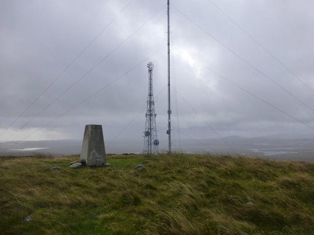 Photo could not load
NB3030 : Eitshal Summit
Rude Health
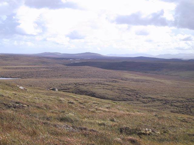 Photo could not load
NB3030 : Eitseal from Beinn Rathacleit
Philip
Hill facts and local notes
Classifications
Elevation
223m
732 ft
Prominence
111m
Coordinates
58.1805, -6.5857
NB305304
OS Map
8 13
Explorer: 459W
At the Summit
The summit features a charming stone cairn, which serves as a perfect picnic spot. Just make sure to leave no crumbs behind; the local wildlife has a keen sense of smell!
Terrain & Geology
Eitseal is primarily composed of Gneiss, which is metamorphic rock formed under high pressure and temperature. The area's geological history offers insights into the ancient environments that existed here, going back over a billion years.
Views & Scenery
From the summit, you can enjoy panoramic views of the Hebrides, including the mystical silhouette of Skye on a clear day, along with the shimmering waters of Loch Eitshal.
History & Heritage
Name Origin
The name 'Eitseal' is thought to derive from the Gaelic 'Eitheal', meaning 'a hill of fracture', tying into the region's geological history.
Historical Significance
Eitseal is not just a pretty face; it has significance in local folklore, often featured in stories told by the fireside in nearby communities.
Getting There & Facilities
Check current local access restrictions, parking rules and transport timetables before travelling. These notes do not confirm public access to the summit.
Parking
Parking is available at Eitshal village; a small area suitable for around 5-6 cars. It's often best to arrive early during peak season.
Public Transport
Regular bus services run from Stornoway to various points near Eitshal, with the nearest stop being just a short walk from the parking area.
Nearby Facilities
While there are no facilities on the route itself, Stornoway has excellent options like cafés and public toilets, perfect for a pre-hike coffee fix.
Safety Information
Known Hazards
- Beware of occasional boggy patches, especially after rainfall. Also, navigating the rocky paths requires careful footing.
General Safety Tips
- Check weather conditions before setting out
- Carry appropriate clothing and equipment
- Let someone know your planned route
- Take a map, compass, and GPS device
- Carry emergency supplies: food, water, first aid kit, torch
Hills
Some common questions about the hills answered
Are there group walks up Eitseal [Eitshal]?
Many walkers use Walkmates to join or organise walks with others. You can check for group walks around Eitseal [Eitshal] through the maps
Are there other walkers around Eitseal [Eitshal]?
Activity varies by location and time, but Walkmates lets you see whether others have shared walks or shown interest in this area. Find other people through the walking friends search walking friends for Eitseal [Eitshal] search or of course create your own walk for Eitseal [Eitshal]
Can I organise a walk to Eitseal [Eitshal]?
Yes. If there aren’t any walks listed already, you can create a walk and make it available for others to join.
If you're signed up to Walkmates, you can create a walk to Eitseal [Eitshal].
How do I find a walk up this hill?
There are often multiple ways to walk this hill, depending on experience and route preference. Walkmates helps you explore walks and routes that others have shared.
Can I suggest a new route up Eitseal [Eitshal]?
Yes. You can suggest or create routes to share with others. Walkmates focuses on the social side of walking, so routes are used to help people organise walks and explore areas together, rather than as detailed navigation tools or route libraries.
Other uses really appreciate knowledgeable walkers sharing their routes. Share your favourite route to Eitseal [Eitshal] here
The is an error or something incorrect about this hill. How do I let you know?
We always strive to keep the information on Walkmates as accurate as possible. If you find an error, please let us know through the contact form and we'll aim to correct it as quickly as possible
Community Discussion
Comments
Location
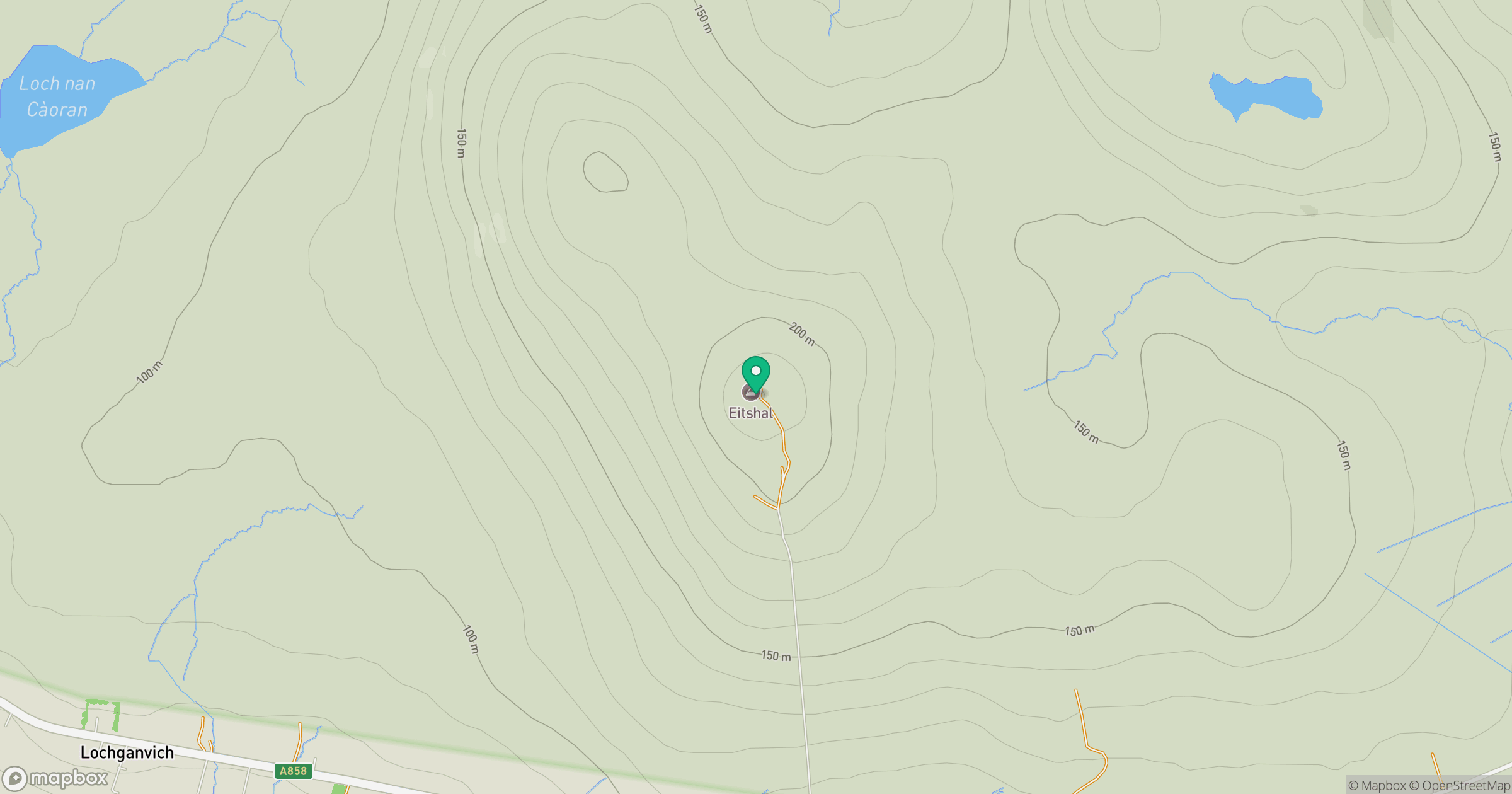
Grid reference: NB305304
View on OpenStreetMapOpens a map in a new tab, centred on the hill.
Hills within 30 km
Straight-line distance, not a walking route or confirmation of access.
An Cliseam [Clisham]
800m
Beinn Mholach
292m
Mullach Breac Mhalasgair
172m
Beinn Bhragair
262m
Roineabhal [Roineval]
281m
No comments yet. Be the first.